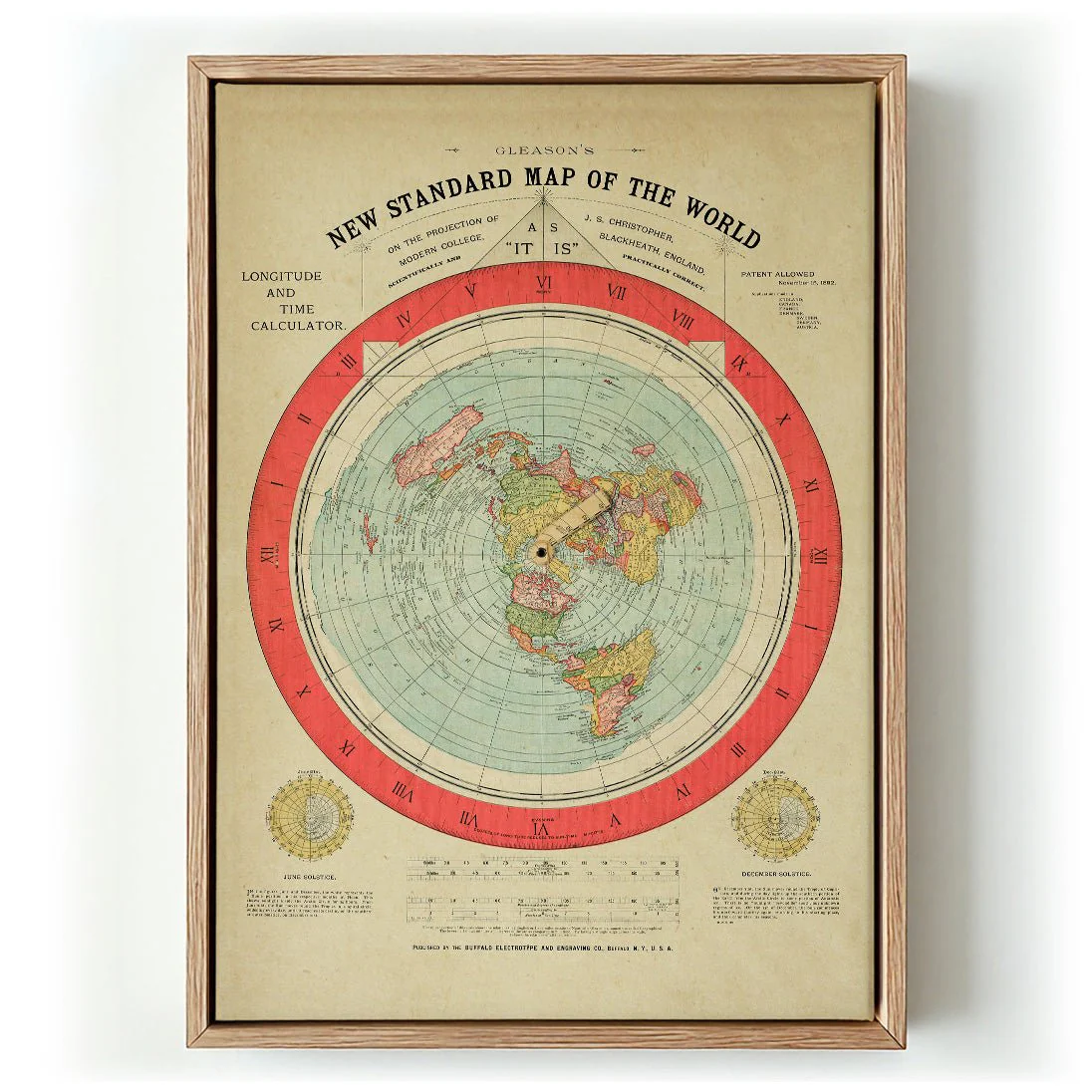
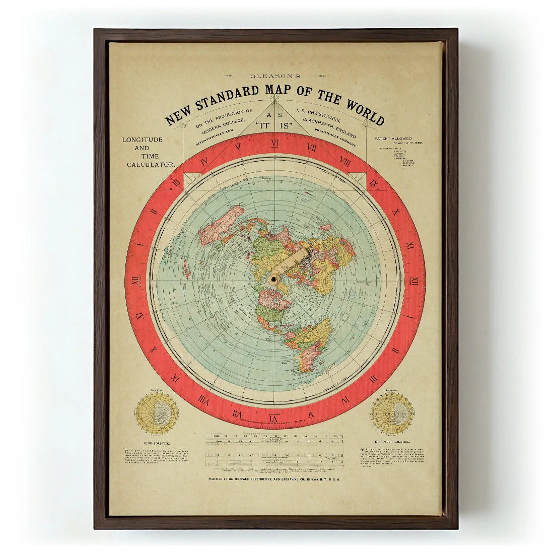
Flat of the World by Gleason
Gleason's 1892 'Flat of the World' chart is one of the most visually arresting cartographic documents of the Victorian era — a detailed, azimuthal projection that presents the earth as a flat disc radiating outward from the North Pole. Every continent is rendered in careful period typography and ornate geographical notation, the whole image framed by decorative borders that speak to the graphic design conventions of late 19th-century scientific publishing. The work sits at the intersection of belief, data, and craft, making it as compelling an object today as it was controversial in its time.
Produced as a canvas print, the map's fine linework and dense textual detail settle into the woven surface without losing legibility. The warm canvas tone enhances the aged parchment quality of the original, making this canvas art print feel genuinely archival.
Original: $38.34
-65%$38.34
$13.42More Images
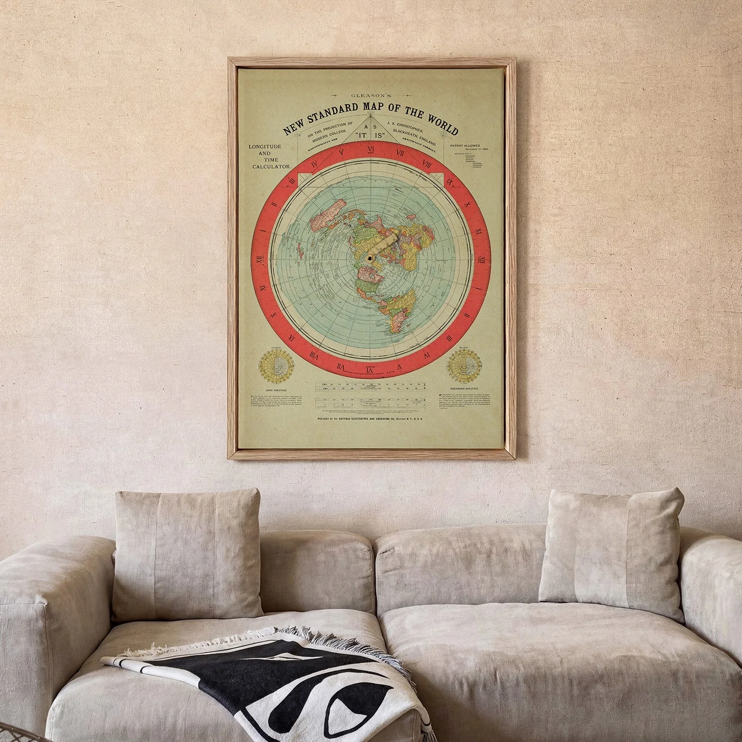


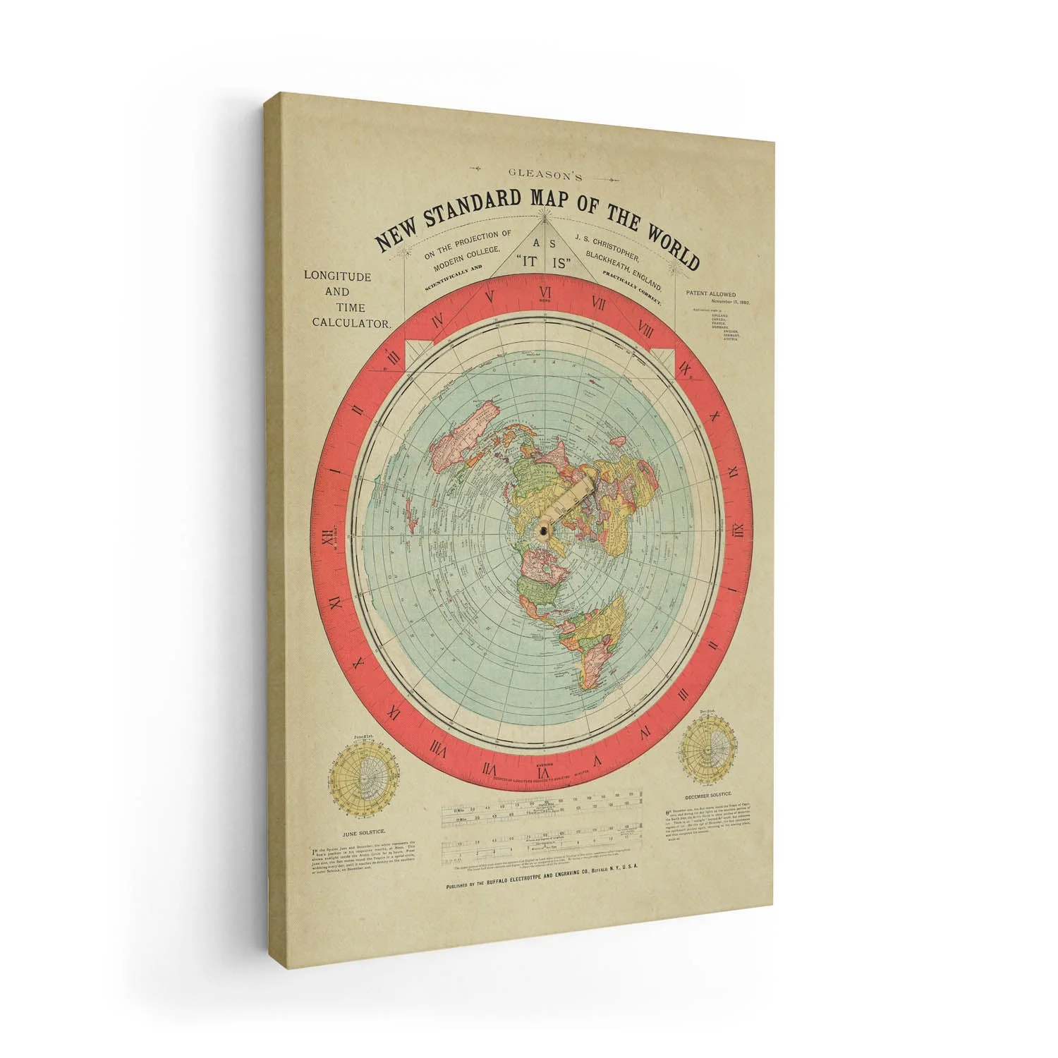
Flat of the World by Gleason
Gleason's 1892 'Flat of the World' chart is one of the most visually arresting cartographic documents of the Victorian era — a detailed, azimuthal projection that presents the earth as a flat disc radiating outward from the North Pole. Every continent is rendered in careful period typography and ornate geographical notation, the whole image framed by decorative borders that speak to the graphic design conventions of late 19th-century scientific publishing. The work sits at the intersection of belief, data, and craft, making it as compelling an object today as it was controversial in its time.
Produced as a canvas print, the map's fine linework and dense textual detail settle into the woven surface without losing legibility. The warm canvas tone enhances the aged parchment quality of the original, making this canvas art print feel genuinely archival.
Product Information
Product Information
Shipping & Returns
Shipping & Returns
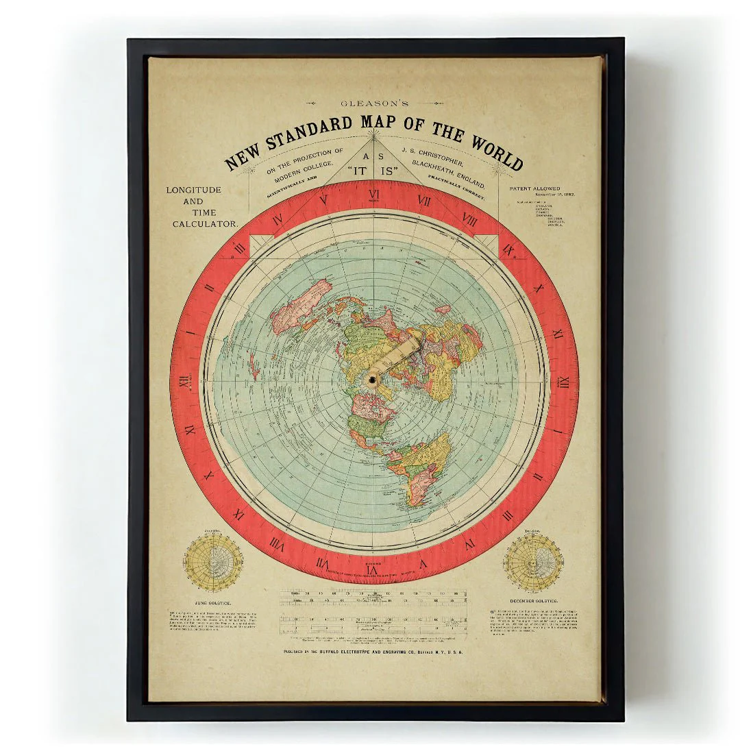
Description
Gleason's 1892 'Flat of the World' chart is one of the most visually arresting cartographic documents of the Victorian era — a detailed, azimuthal projection that presents the earth as a flat disc radiating outward from the North Pole. Every continent is rendered in careful period typography and ornate geographical notation, the whole image framed by decorative borders that speak to the graphic design conventions of late 19th-century scientific publishing. The work sits at the intersection of belief, data, and craft, making it as compelling an object today as it was controversial in its time.
Produced as a canvas print, the map's fine linework and dense textual detail settle into the woven surface without losing legibility. The warm canvas tone enhances the aged parchment quality of the original, making this canvas art print feel genuinely archival.